APPENDIX 2:-
The shape of the settlement. -
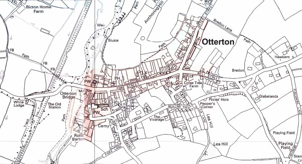
A current map of Otterton depicting the conservation area boundary:
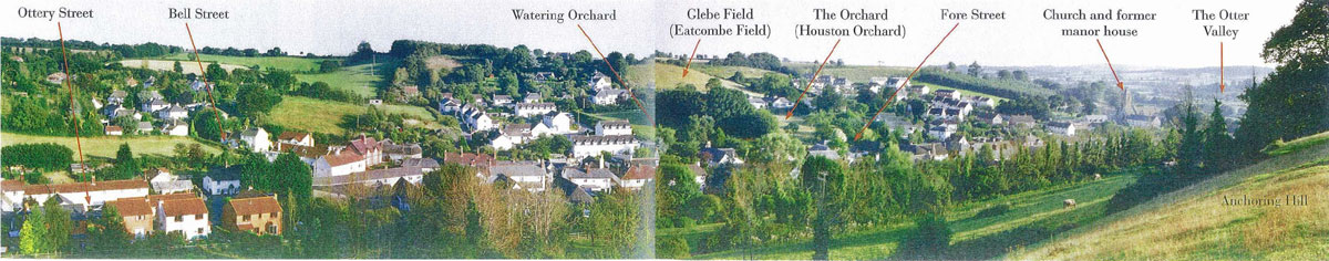
A Photographic panorama of Otterton looking south from Anchoring Hill, illustrating the current composition of infill and open space.
The prominence and visual importance of the valley slopes and green space within the village to the essential character of the settlement are plain. Further infil of any significant volume would distort that balance and erode the rural nature of the settlement: